Lives saved
1

Flying

Mountain
Medical emergency
Thunder storm
San Bernardino, CA
34.1083449°N, -117.2897652°W
Posted on May 3, 2018 by Dietch
What happened?
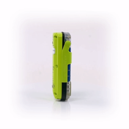
On Friday July 10, 2015, I launched my hang glider from Crestline overlooking San Bernardino, CA and headed 13 miles east toward Running Springs. From an altitude of 7,100′ MSL, I decided to cross the gap toward 7,800′ Keller Peak. I have made this flight numerous times over the past 6 years with only a few close calls but no major incidents. During the summer of 2010, a friend crashed his hang glider in a rural area and was lost. Although he was rescued while still unconsciouis the following morning I decided to fly with a NOAA-registered SARSAT beacon. After careful research I chose ACR SARLink 406 for my specific needs. From July, 2010 through July, 2015, I have carried that PLB on approximately 500 flights spanning a thousand hours of flying time. Most of my hang gliding consists of flying as far as I can for the given conditions; which is known as cross-country or X/C flying. I am accustomed to landing places I have never seen and calling friends for a retrieve ride or being followed by vehicle using 2-meter radio for communication.
On this flight the lift rapidly began to fade out as I reached Keller Peak at 6,400′ MSL. It is an 8-mile long glide to clear the Seven Oaks earthen dam located at the source of the Santa Ana River in Mentone, CA. I was already too low to glide out and failed to climb more than a few hundred feet before it was clear to me I wasn’t leaving by hang glider. I glided back toward Running Springs but only continued to bleed altitude. I opted to return toward the foot of Keller Peak where there is an unoccupied hydro-electric plant. My landing strip would be in the boulder-filled, dry Santa Ana River bed. I managed a safe landing between large boulders but was faced with a long hike out late in the day. There is a local population of mountain lions, rattle snakes, coyotes and assorted predatory beings. I had a long hike out down a canyon defined by mountains on either side of the riverbed. Nobody knew my whereabouts as I had been flying solo. Nobody responded to my 2-meter radio calls and there was no cell reception. This was during a recent rash of fires due to the drought but between fires at the time. There are USFS and Sheriff’s helicopter pads are located in a 15-mile radius. Rather than trying to hike out into the night with inadequate supplies, I opted to activate my SARLink as soon as I got out of my harness before I began to break down my equipment.
After 40 minutes without the sound of a helicopter I opted to leave my packed up glider in an obvious spot on the access road and hike out. I had the SARKLink PLB in my harness bag on my back and it was left on and transmitting. After several hours I hit a dead end behind the dam. I began to backtrack to the correct fork in the road when a helicopter finally flew into the canyon toward my landing spot. I continued backtracking as the helicopter flew back out and over my head as I waved in plain sight. I reached for my glass signal mirror with retro-reflective aiming center and lit up the chopper with reflected sunlight as it continued its egress over the dam. Finally, the copper did an about face as the sun was kissing the ridgeline to the West and I was about to go into shade. I was picked up and dropped off by the Mill Creek Ranger Station in Yucaipa, CA without incident. Although my SARLink PLB is equipped with a strobe, there would have been an interval of dusk in which I had no way to signal other than by whistle. Once we exited the helicopter, the pilot showed me his own, well-worn signal mirror and thanked me for using mine along with the PLB. The next day I called the Air Force base where NOAA-registered PLBs are tracked and verified that my beacon signal had gotten picked up two minutes after activation. This was reassuring to me as a significant portion of the sky was blocked by surrounding mountains. The following morning I was able to drive back in with a friend on his Jeep 4X and recovered my glider. I went flying that afternoon.
Words of wisdom
Rather than trying to hike out into the night with inadequate supplies, I opted to activate my SARLink as soon as I got out of my harness before I began to break down my equipment.
Thank you note
Thank you ACR!
Rescue location
San Bernardino, CA
Rescue team
Other